
Europe is a hiker’s paradise, offering a rich tapestry of trails that cater to all levels of experience and adventure. From the rugged peaks of the Alps to the serene coastal paths of the Mediterranean, each trail provides a unique glimpse into the continent’s diverse landscapes and cultures. Hiking in Europe not only allows you to immerse yourself in breathtaking natural beauty but also to explore historical routes, discover hidden villages, and experience local traditions.
Whether you’re an experienced mountaineer looking for your next challenging ascent, or a casual walker eager to enjoy scenic strolls through picturesque countryside, Europe’s hiking trails have something for everyone. In this guide, we’ll take you on a journey through ten of the best hiking trails in Europe. Each trail has been selected for its outstanding scenery, unique features, and the unforgettable experiences it offers.
We will provide you with essential information about each trail, including key highlights, practical tips, and accommodation options. You’ll learn about the best times to visit, what to pack, and how to prepare for your adventure. Whether you’re planning a solo trek, a family vacation, or a group expedition, this guide will help you make the most of your hiking experience.
So lace up your hiking boots, pack your backpack, and get ready to explore some of the most spectacular trails Europe has to offer. Let’s embark on a journey through nature’s wonders and discover the best hiking trails in Europe.
1. Tour du Mont Blanc (France, Italy, Switzerland)
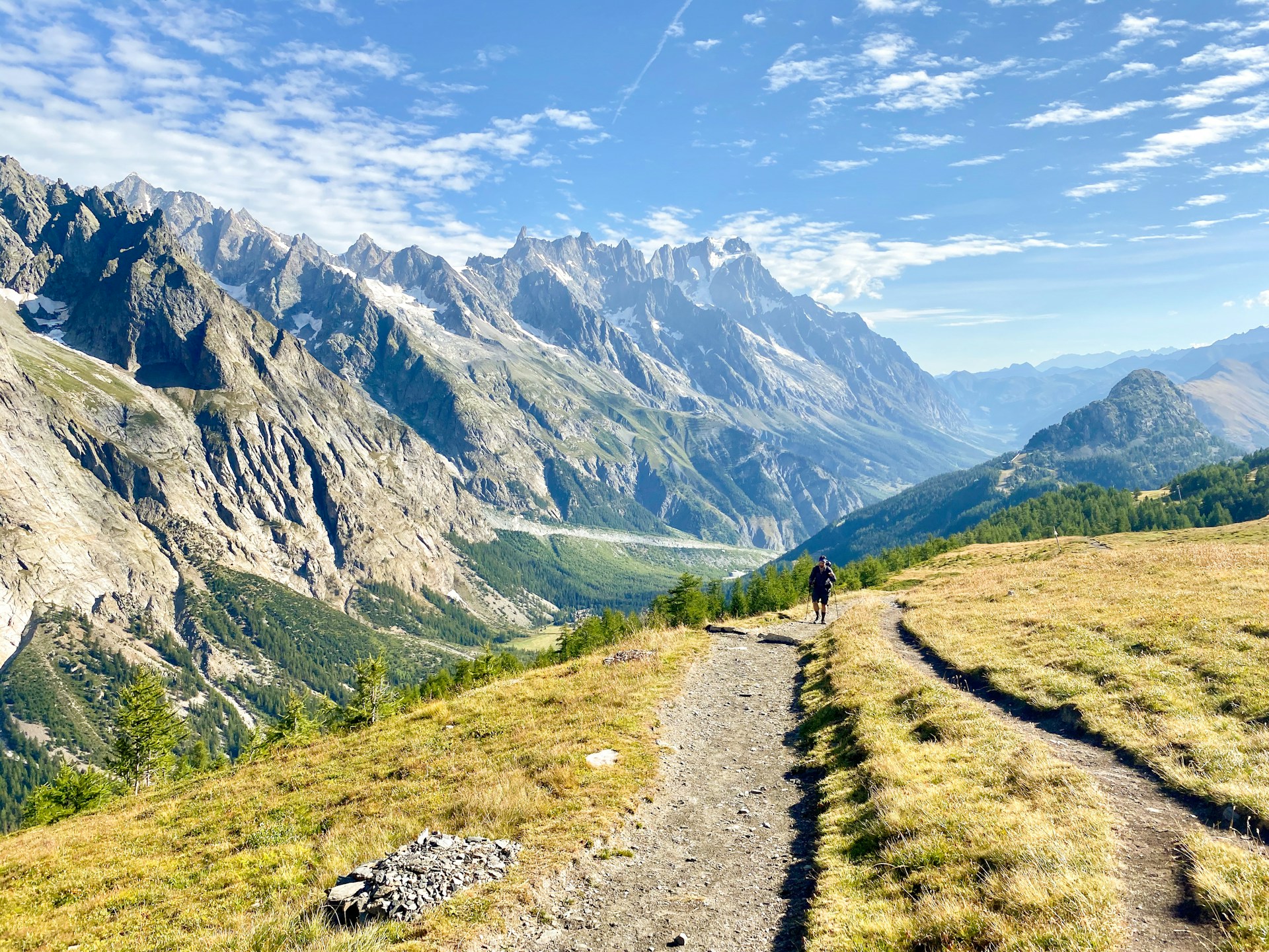
The Tour du Mont Blanc (TMB) is one of Europe’s premier long-distance hiking trails, circling the Mont Blanc massif over a distance of approximately 170 kilometers (105 miles). This trail traverses the borders of three countries: France, Italy, and Switzerland, providing hikers with a rich cultural and natural experience. The trail typically takes about 10 to 12 days to complete, depending on the pace and chosen route variations.
Highlights
Mont Blanc: The centerpiece of the trail, Mont Blanc, stands at 4,810 meters (15,781 feet) and is the highest peak in the Alps. The trail offers breathtaking views of its snow-capped summit and surrounding glaciers.
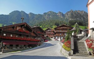
Charming Alpine Villages: The trail passes through several picturesque villages, including Chamonix (France), Courmayeur (Italy), and Champex (Switzerland). Each village has its own unique charm, culture, and history, offering opportunities to experience local cuisine and hospitality.
Diverse Landscapes: Hikers will encounter a wide variety of landscapes, from verdant valleys and lush meadows to rocky passes and serene lakes. Key scenic spots include the Aiguille Rouge nature reserve, the Grand Col Ferret pass, and the Trient Glacier.
Tips for Hikers
Best Time to Visit: The trail is best hiked between late June and early September. During this period, the weather is generally more stable, and most of the mountain huts (refuges) are open. Early summer offers blooming wildflowers, while late summer provides more stable weather conditions.
Essential Gear:
- Footwear: Sturdy, well-broken-in hiking boots with good ankle support.
- Clothing: Layered clothing to adjust to changing weather conditions, including a waterproof jacket, thermal layers, and lightweight, moisture-wicking base layers.
- Equipment: Trekking poles for stability on steep and uneven terrain, a map and compass or GPS device, and a lightweight backpack.
- Other Essentials: Sunscreen, sunglasses, a hat, a first aid kit, a water bottle or hydration system, and high-energy snacks.
Fitness Level: The TMB is a challenging trail with significant elevation changes, including several high mountain passes. Hikers should be in good physical condition and prepared for strenuous days, with ascents and descents that can be physically demanding.
Accommodation
Mountain Huts (Refuges): These are scattered along the trail and provide basic lodging and meals. Staying in a refuge offers a chance to meet fellow hikers and share experiences. Reservations are highly recommended, especially during peak season.
Guesthouses and Hotels: Found in the larger villages and towns along the route, these offer more comfort with amenities such as hot showers, private rooms, and sometimes even wellness facilities. Examples include Hotel Le Chamonix in Chamonix and Hotel Edelweiss in Courmayeur.
Camping: For those who prefer a more rugged and flexible experience, there are designated camping areas along the trail. Wild camping is regulated, and it’s essential to check local rules and regulations.
Day-by-Day Itinerary Example
- Day 1: Les Houches to Les Contamines – A gentle start with views of the Bionnassay Glacier.
- Day 2: Les Contamines to Les Chapieux – Pass the Col du Bonhomme and enjoy views of the Mont Blanc range.
- Day 3: Les Chapieux to Rifugio Elisabetta – Cross into Italy via the Col de la Seigne, with panoramic views of the Italian Alps.
- Day 4: Rifugio Elisabetta to Courmayeur – Descend into the Italian town of Courmayeur, known for its charming streets and delicious cuisine.
- Day 5: Courmayeur to Rifugio Bonatti – Hike through Val Ferret with stunning views of the Grandes Jorasses.
- Day 6: Rifugio Bonatti to La Fouly – Cross the Grand Col Ferret into Switzerland, descending to the quaint village of La Fouly.
- Day 7: La Fouly to Champex – A relatively easy day through Swiss meadows and forests, ending at the lovely lakeside town of Champex.
- Day 8: Champex to Trient – Traverse the Bovine Route or Fenêtre d’Arpette, both offering spectacular views.
- Day 9: Trient to Argentiere – Cross back into France via the Col de Balme, with vistas over the Chamonix Valley.
- Day 10: Argentiere to Chamonix – A final trek through the Aiguilles Rouges nature reserve, with Mont Blanc looming large as you return to Chamonix.
The Tour du Mont Blanc is a challenging yet rewarding trek that offers hikers an unparalleled experience of the Alpine region’s natural beauty and cultural richness. Whether you seek the thrill of high mountain passes or the tranquility of alpine meadows, the TMB promises an unforgettable adventure.
2. Camino de Santiago (Spain)
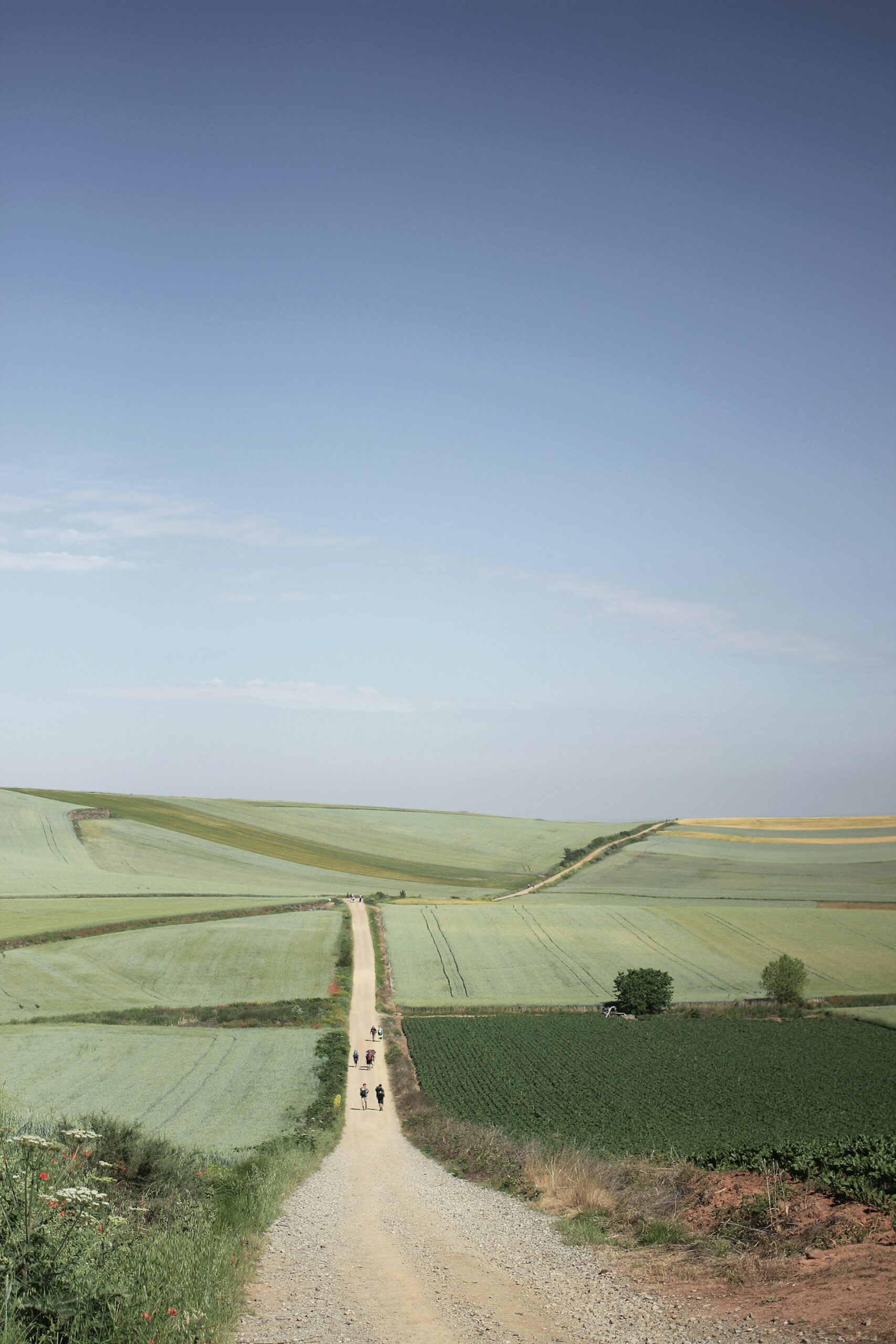
The Camino de Santiago, also known as the Way of St. James, is a network of ancient pilgrimage routes that converge at the shrine of the apostle Saint James the Great in the Cathedral of Santiago de Compostela in northwest Spain. The most popular route, the Camino Francés, spans approximately 800 kilometers (500 miles) from Saint-Jean-Pied-de-Port in France to Santiago de Compostela in Spain. This historic trail has been a significant pilgrimage path for over a thousand years and continues to attract thousands of pilgrims and hikers from around the world.

Highlights
Cultural Heritage: The Camino is rich in historical and cultural landmarks, including medieval churches, monasteries, and UNESCO World Heritage sites such as the Cathedral of Santiago de Compostela.
Diverse Landscapes: The trail traverses a variety of landscapes, from the rolling hills of the Basque Country and the vast plains of the Meseta to the lush green hills of Galicia.
Spiritual Journey: For many, walking the Camino is a deeply spiritual and transformative experience. The trail is marked with symbols of pilgrimage, including scallop shells and stone crosses.
Tips for Hikers
Best Time to Visit: The best times to hike the Camino are during spring (April to June) and autumn (September to October) when the weather is mild and the trail is less crowded.
Essential Gear:
- Footwear: Comfortable, well-broken-in walking shoes or hiking boots.
- Clothing: Lightweight, moisture-wicking clothing, a hat, and a rain jacket.
- Equipment: A lightweight backpack, water bottle, sunscreen, and a walking stick or trekking poles.
- Other Essentials: A pilgrim’s passport (credencial) for accommodation and stamping, a guidebook, and a first aid kit.
Fitness Level: The Camino Francés is accessible to hikers of all fitness levels. The trail is well-marked and maintained, with plenty of services and facilities along the way.
Accommodation
Albergues (Pilgrim Hostels): These are the most common type of accommodation on the Camino. They are often run by municipalities, churches, or private owners and offer basic dormitory-style lodging at a low cost. Reservations are generally not required, but it’s good to arrive early to secure a spot.
Hotels and Guesthouses: For those seeking more comfort, there are numerous hotels, guesthouses, and private hostels along the route offering private rooms and additional amenities.
Paradors: In some locations, you can stay in historic buildings converted into luxury hotels, offering a unique and upscale experience.
Day-by-Day Itinerary Example
- Day 1: Saint-Jean-Pied-de-Port to Roncesvalles – A challenging start crossing the Pyrenees into Spain.
- Day 2: Roncesvalles to Zubiri – A scenic walk through forests and small villages.
- Day 3: Zubiri to Pamplona – Arrive in the historic city known for its Running of the Bulls festival.
- Day 4: Pamplona to Puente la Reina – Cross the medieval bridge that gives the town its name.
- Day 5: Puente la Reina to Estella – Walk through vineyards and rolling hills.
- Day 6: Estella to Los Arcos – Visit the famous wine fountain at Irache Monastery.
- Day 7: Los Arcos to Logroño – Enter the Rioja wine region.
- Day 8: Logroño to Nájera – Pass through vineyards and ancient villages.
- Day 9: Nájera to Santo Domingo de la Calzada – Visit the town known for its cathedral with a live chicken coop.
- Day 10: Santo Domingo de la Calzada to Belorado – A walk through wheat fields and small towns.
- Day 11: Belorado to Burgos – Arrive in the historic city of Burgos, home to a stunning Gothic cathedral.
- Day 12: Burgos to Hornillos del Camino – Begin crossing the Meseta, a flat and expansive plateau.
- Day 13: Hornillos del Camino to Castrojeriz – Continue across the Meseta, passing through quiet villages.
- Day 14: Castrojeriz to Frómista – Visit the Romanesque church of San Martín in Frómista.
- Day 15: Frómista to Carrión de los Condes – Walk along the Canal de Castilla.
- Day 16: Carrión de los Condes to Calzadilla de la Cueza – A remote stretch with few services.
- Day 17: Calzadilla de la Cueza to Sahagún – Reach the halfway point of the Camino Francés.
- Day 18: Sahagún to El Burgo Ranero – A peaceful walk through rural landscapes.
- Day 19: El Burgo Ranero to León – Explore the historic city of León, known for its cathedral and lively atmosphere.
- Day 20: León to Villar de Mazarife – Leave León and walk through quiet countryside.
- Day 21: Villar de Mazarife to Astorga – Visit the Episcopal Palace designed by Gaudí in Astorga.
- Day 22: Astorga to Rabanal del Camino – Begin the ascent towards the mountains of León.
- Day 23: Rabanal del Camino to Ponferrada – Cross the highest point of the Camino at Cruz de Ferro.
- Day 24: Ponferrada to Villafranca del Bierzo – Enter the Bierzo valley, known for its vineyards.
- Day 25: Villafranca del Bierzo to O Cebreiro – A challenging climb into Galicia.
- Day 26: O Cebreiro to Triacastela – Walk through the lush Galician landscape.
- Day 27: Triacastela to Sarria – A scenic route through green valleys.
- Day 28: Sarria to Portomarín – Cross the Miño River and enter the final stretch of the Camino.
- Day 29: Portomarín to Palas de Rei – Continue through the Galician countryside.
- Day 30: Palas de Rei to Arzúa – Pass through small hamlets and farms.
- Day 31: Arzúa to O Pedrouzo – A final day before reaching Santiago de Compostela.
- Day 32: O Pedrouzo to Santiago de Compostela – Arrive at the Cathedral of Santiago de Compostela, the culmination of the pilgrimage.
The Camino de Santiago offers a unique blend of physical challenge, cultural immersion, and spiritual reflection. Whether you walk for religious reasons, personal growth, or simply the love of hiking, the Camino promises a profound and memorable journey.
3. Rota Vicentina (Portugal)

The Rota Vicentina is a network of walking trails along the southwestern coast of Portugal. It comprises two main routes: the Historical Way and the Fishermen’s Trail. The Fishermen’s Trail is particularly famous, running along the rugged Atlantic coastline from Porto Covo to Odeceixe, covering approximately 120 kilometers (75 miles). This trail offers hikers stunning coastal views, charming fishing villages, and a diverse array of flora and fauna.
Highlights
Scenic Coastal Views: The Fishermen’s Trail provides dramatic views of the Atlantic Ocean, steep cliffs, and hidden beaches. Key spots include Cabo Sardão and the beach at Zambujeira do Mar.
Traditional Fishing Villages: The trail passes through several picturesque villages where hikers can experience local culture and cuisine. Notable villages include Porto Covo, Vila Nova de Milfontes, and Almograve.
Diverse Flora and Fauna: The trail is part of the Southwest Alentejo and Vicentine Coast Natural Park, home to a rich variety of plant and animal life, including storks, otters, and numerous endemic plant species.
Tips for Hikers
Best Time to Visit: The best times to hike the Rota Vicentina are during spring (March to June) and autumn (September to November) when the weather is mild, and the trail is less crowded. Summer can be very hot, while winter might bring rain and strong winds.
Essential Gear:
- Footwear: Comfortable walking shoes or hiking boots suitable for coastal terrain.
- Clothing: Lightweight, moisture-wicking clothing, a hat, and a windproof jacket.
- Equipment: A lightweight backpack, water bottle, sunscreen, and a first aid kit.
- Other Essentials: A detailed map or GPS device and a camera to capture the stunning views.
Fitness Level: The Fishermen’s Trail is moderately difficult, with some sections requiring careful navigation along cliffs and sandy paths. Hikers should be prepared for uneven terrain and be in good physical condition.
Accommodation
Eco-friendly Lodgings: Many accommodations along the Rota Vicentina are committed to sustainable practices. Options range from small guesthouses to eco-friendly lodges.
Guesthouses and Small Hotels: Available in the villages along the trail, offering comfortable stays with local hospitality. Examples include Casas Brancas in Vila Nova de Milfontes and Herdade do Touril near Zambujeira do Mar.
Camping: Designated campsites are available, providing a more rugged and immersive experience. Wild camping is generally discouraged to protect the natural environment.
Day-by-Day Itinerary Example
- Day 1: Porto Covo to Vila Nova de Milfontes – Start the journey with stunning coastal views and charming fishing villages. Distance: 20 kilometers (12 miles).
- Day 2: Vila Nova de Milfontes to Almograve – Cross the Mira River by boat (seasonal) or bridge and walk through dunes and along cliffs. Distance: 15 kilometers (9 miles).
- Day 3: Almograve to Zambujeira do Mar – Experience a mix of rocky coastlines and sandy beaches, ending in a beautiful seaside town. Distance: 22 kilometers (14 miles).
- Day 4: Zambujeira do Mar to Odeceixe – Pass by Cabo Sardão lighthouse and finish at the charming village of Odeceixe, known for its scenic beach. Distance: 18 kilometers (11 miles).
Extended Itinerary on the Historical Way
For those interested in a longer hike, the Historical Way offers an additional inland route covering 230 kilometers (143 miles) from Santiago do Cacém to Cabo de São Vicente. This route traverses rural landscapes, cork oak forests, and rolling hills, providing a different perspective of the region.
The Rota Vicentina’s Fishermen’s Trail offers hikers a unique opportunity to explore Portugal’s stunning coastline, experience traditional village life, and immerse themselves in the natural beauty of the Southwest Alentejo and Vicentine Coast Natural Park. Whether you’re seeking solitude, scenic beauty, or a taste of local culture, this trail promises an unforgettable adventure.
4. West Highland Way (Scotland)

The West Highland Way is one of Scotland’s most famous long-distance hiking trails, stretching 154 kilometers (96 miles) from Milngavie, near Glasgow, to Fort William, at the foot of Ben Nevis. This trail offers hikers the chance to experience the rugged beauty of the Scottish Highlands, including serene lochs, dramatic glens, and ancient forests.
Highlights
Loch Lomond: The trail follows the eastern shores of Loch Lomond, providing stunning views of Scotland’s largest freshwater loch and its surrounding mountains.
Rannoch Moor: A vast, open expanse of boggy moorland that offers a true sense of wilderness and isolation.
Glen Coe: Known for its breathtaking scenery and historical significance, Glen Coe is often considered one of the most beautiful places in Scotland.
Ben Nevis: The trail concludes in Fort William, the gateway to Ben Nevis, the highest peak in the British Isles.
Tips for Hikers
Best Time to Visit: The ideal hiking season for the West Highland Way is from April to October. Spring and early summer offer the best weather, with blooming wildflowers and fewer midges (small biting insects).
Essential Gear:
- Footwear: Waterproof hiking boots with good ankle support.
- Clothing: Layered clothing to cope with Scotland’s variable weather, including a waterproof jacket and thermal layers.
- Equipment: A lightweight backpack, trekking poles, a map and compass or GPS device, and a first aid kit.
- Other Essentials: Insect repellent (for midges), sunscreen, and a water bottle or hydration system.
Fitness Level: The West Highland Way is suitable for hikers of moderate fitness levels. The trail includes some challenging sections, particularly around Glen Coe and the ascent of the Devil’s Staircase, but is generally well-marked and maintained.
Accommodation
Campsites: There are numerous campsites along the trail for those who prefer to camp. Facilities vary, so it’s important to plan ahead.
Hostels and Bunkhouses: Budget-friendly options are available in key locations such as Rowardennan, Tyndrum, and Kinlochleven.
Bed and Breakfasts (B&Bs): Enjoy Scottish hospitality in B&Bs scattered along the route, offering comfortable rooms and hearty breakfasts. Examples include Drymen’s Hillview B&B and Inveroran Hotel.
Hotels: For more comfort, there are hotels in the larger towns and villages, such as the Oak Tree Inn in Balmaha and the Kingshouse Hotel in Glen Coe.
Day-by-Day Itinerary Example
- Day 1: Milngavie to Drymen – A gentle start through rolling countryside and farmland. Distance: 19 kilometers (12 miles).
- Day 2: Drymen to Rowardennan – Enter Loch Lomond and the Trossachs National Park, with views of Loch Lomond. Distance: 24 kilometers (15 miles).
- Day 3: Rowardennan to Inverarnan – Follow the rugged eastern shore of Loch Lomond. Distance: 22 kilometers (14 miles).
- Day 4: Inverarnan to Tyndrum – Pass through Glen Falloch and enjoy views of the surrounding mountains. Distance: 21 kilometers (13 miles).
- Day 5: Tyndrum to Inveroran – Walk through remote highlands and Rannoch Moor. Distance: 15 kilometers (9 miles).
- Day 6: Inveroran to Kingshouse – Traverse the stunning Rannoch Moor, a true highlight of the trail. Distance: 16 kilometers (10 miles).
- Day 7: Kingshouse to Kinlochleven – Climb the Devil’s Staircase, the highest point of the trail, then descend into Kinlochleven. Distance: 14 kilometers (9 miles).
- Day 8: Kinlochleven to Fort William – Finish the journey with a walk through Lairig Mor, ending at the foot of Ben Nevis. Distance: 24 kilometers (15 miles).
The West Highland Way offers hikers a quintessential Scottish experience, combining stunning natural beauty with rich history and culture. Whether you’re drawn by the serene landscapes of Loch Lomond, the wild expanses of Rannoch Moor, or the dramatic scenery of Glen Coe, this trail promises an unforgettable adventure through the heart of the Scottish Highlands.
5. Triglav National Park (Slovenia)

Triglav National Park is Slovenia’s only national park and is named after the country’s highest peak, Mount Triglav, which stands at 2,864 meters (9,396 feet). Covering 880 square kilometers (340 square miles), the park offers a diverse range of landscapes, including alpine meadows, glacial valleys, dense forests, and pristine lakes. It is a haven for hikers seeking to explore the unspoiled beauty of the Julian Alps.
Highlights
Mount Triglav: The iconic peak and a symbol of Slovenia, climbing Mount Triglav is considered a rite of passage for Slovenians. The ascent offers breathtaking panoramic views.
Lake Bohinj: The largest permanent lake in Slovenia, known for its crystal-clear waters and serene surroundings.

Seven Lakes Valley: A picturesque glacial valley with a series of beautiful alpine lakes, perfect for a multi-day trek.
Soča River: Known for its emerald-green waters, the Soča River is a popular spot for rafting, kayaking, and fishing.
Tips for Hikers
Best Time to Visit: The best time for hiking in Triglav National Park is from June to September. During this period, the weather is generally stable, and mountain huts are open. Snow can persist on higher trails until mid-summer.
Essential Gear:
- Footwear: Sturdy, well-broken-in hiking boots with good grip.
- Clothing: Layered clothing for variable mountain weather, including a waterproof jacket and thermal layers.
- Equipment: Trekking poles, a detailed map or GPS device, a headlamp, and a first aid kit.
- Other Essentials: Sunscreen, sunglasses, a hat, and sufficient water and high-energy snacks.
Fitness Level: The trails in Triglav National Park range from easy walks around Lake Bohinj to challenging climbs like Mount Triglav. Hikers should choose routes that match their fitness and experience levels.
Accommodation
Mountain Huts (Domovi or Koče): These are scattered throughout the park and provide basic lodging and meals. They are essential for multi-day hikes and climbing Mount Triglav. Examples include Dom Planika and Triglavski Dom na Kredarici.
Guesthouses and Hotels: Available in the nearby towns and villages, offering more comfort and amenities. Examples include Hotel Jezero near Lake Bohinj and Hotel Boka in Bovec.
Campsites: Designated camping areas are available for those who prefer to camp. Wild camping is regulated to protect the natural environment.
Day-by-Day Itinerary Example
- Day 1: Lake Bohinj to Komna Hut – Start with a scenic hike along the shores of Lake Bohinj, then ascend to the Komna Hut. Distance: 15 kilometers (9 miles).
- Day 2: Komna Hut to Seven Lakes Valley – Explore the picturesque Seven Lakes Valley, with opportunities for stunning photos and serene moments by the lakes. Distance: 12 kilometers (7 miles).
- Day 3: Seven Lakes Valley to Triglavski Dom na Kredarici – Continue your ascent towards Mount Triglav, staying at the highest hut in Slovenia. Distance: 10 kilometers (6 miles).
- Day 4: Summit Mount Triglav – An early start for the final ascent to the summit of Mount Triglav, followed by a descent to Vodnikov Dom for the night. Distance: 8 kilometers (5 miles).
- Day 5: Vodnikov Dom to Lake Bohinj – Descend back to Lake Bohinj, completing your circuit of the Julian Alps. Distance: 14 kilometers (9 miles).
Triglav National Park offers hikers an unparalleled opportunity to explore the rugged beauty of the Julian Alps, with its diverse landscapes and rich biodiversity. Whether you’re scaling the heights of Mount Triglav, wandering through the serene Seven Lakes Valley, or enjoying the tranquility of Lake Bohinj, this park promises an unforgettable adventure in one of Europe’s most pristine natural environments.
6. Laugavegur Trail (Iceland)

The Laugavegur Trail is Iceland’s most famous hiking route, stretching approximately 55 kilometers (34 miles) from Landmannalaugar to Thórsmörk. This trail traverses some of Iceland’s most diverse and dramatic landscapes, including geothermal hot springs, glaciers, volcanic deserts, and lush valleys. The Laugavegur Trail is renowned for its otherworldly beauty and unique geological features.
Highlights
Landmannalaugar: Known for its colorful rhyolite mountains and geothermal hot springs, Landmannalaugar is a stunning starting point for the trail.
Hrafntinnusker: A highland area characterized by obsidian lava fields and geothermal activity.
Alftavatn: A serene lake surrounded by rolling hills and expansive views.
Emstrur: A desert-like area with striking black sand and views of the Myrdalsjökull glacier.
Thórsmörk: A lush, green valley named after the Norse god Thor, providing a beautiful contrast to the volcanic landscapes encountered earlier on the trail.
Tips for Hikers
Best Time to Visit: The best time to hike the Laugavegur Trail is from late June to early September. Outside of this period, the weather can be harsh, and the trail may be impassable due to snow and flooding.
Essential Gear:
- Footwear: Sturdy, waterproof hiking boots.
- Clothing: Layered clothing suitable for Iceland’s unpredictable weather, including a waterproof jacket, thermal layers, and moisture-wicking base layers.
- Equipment: A lightweight backpack, trekking poles, a map and compass or GPS device, and a first aid kit.
- Other Essentials: Sunscreen, sunglasses, a hat, insect repellent, and a water bottle or hydration system.
Fitness Level: The Laugavegur Trail is suitable for hikers of moderate fitness levels. The terrain can be challenging, with river crossings and steep ascents, but the trail is well-marked and maintained.
Accommodation
Mountain Huts: There are several huts along the Laugavegur Trail managed by the Icelandic Touring Association (Ferðafélag Íslands). These huts provide basic lodging and cooking facilities, but reservations are essential, especially during peak season. Examples include the huts at Hrafntinnusker, Alftavatn, and Emstrur.
Camping: Camping is permitted at designated sites near the huts. Campers should be well-prepared for the weather and carry appropriate gear for outdoor sleeping.
Day-by-Day Itinerary Example
- Day 1: Landmannalaugar to Hrafntinnusker – Begin the hike with a steep ascent through colorful rhyolite mountains and geothermal areas. Distance: 12 kilometers (7.5 miles).
- Day 2: Hrafntinnusker to Alftavatn – Cross highland deserts and lava fields, with stunning views of glaciers and volcanic landscapes. Distance: 12 kilometers (7.5 miles).
- Day 3: Alftavatn to Emstrur (Botnar) – Pass through black sand deserts and lush oases, with views of the Myrdalsjökull glacier. Distance: 16 kilometers (10 miles).
- Day 4: Emstrur to Thórsmörk – Descend into the lush valley of Thórsmörk, with its green landscapes and clear rivers. Distance: 15 kilometers (9 miles).
Optional Extension
For those seeking a longer adventure, the Fimmvörðuháls trail extends from Thórsmörk to Skógar, adding another 25 kilometers (15.5 miles) and taking hikers over the Fimmvörðuháls pass between the Eyjafjallajökull and Mýrdalsjökull glaciers.
The Laugavegur Trail offers a truly unique hiking experience, showcasing the incredible geological diversity and raw natural beauty of Iceland. From the vibrant colors of Landmannalaugar to the verdant valley of Thórsmörk, this trail promises an unforgettable journey through one of the world’s most stunning landscapes.
7. Kungsleden (Sweden)
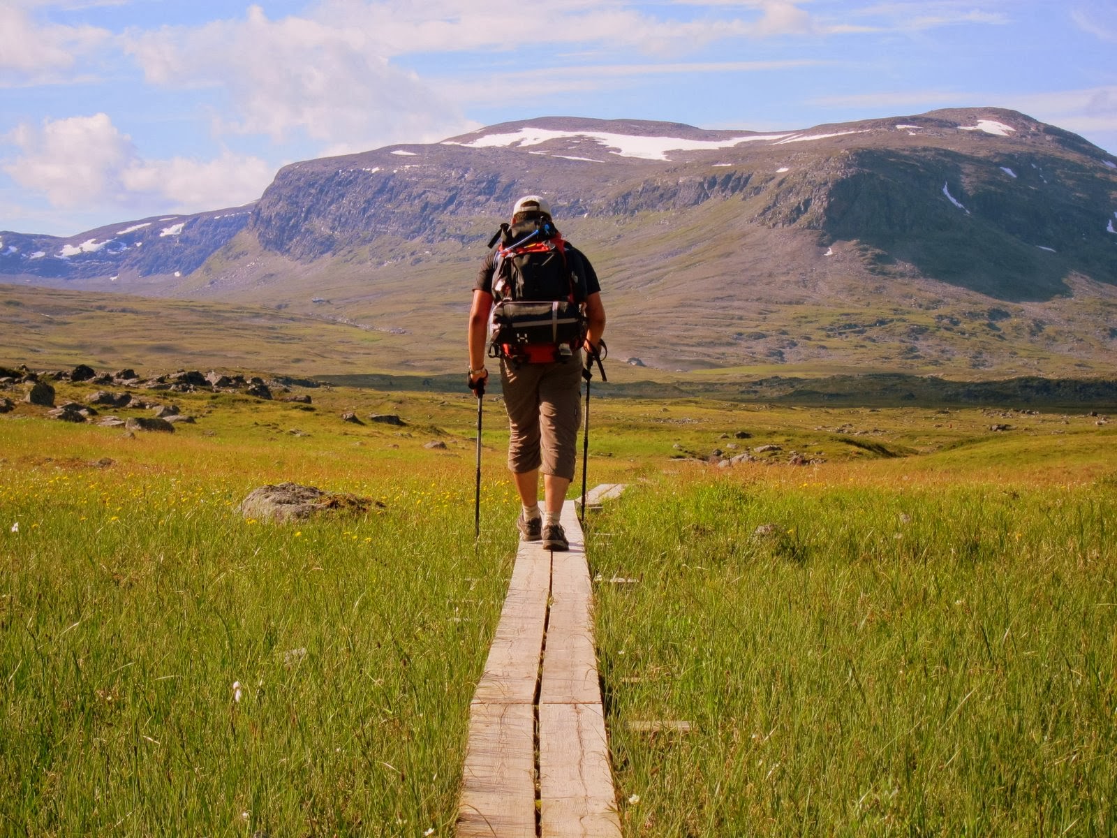
Kungsleden, or the “King’s Trail,” is one of Sweden’s most renowned long-distance hiking routes. It stretches approximately 440 kilometers (273 miles) through the stunning wilderness of northern Sweden, from Abisko in the north to Hemavan in the south. The trail offers hikers an incredible journey through the Arctic landscape, including pristine forests, expansive valleys, and towering peaks.
Highlights
Abisko National Park: The trail begins in this beautiful national park, known for its unique flora and fauna, as well as the Midnight Sun and Northern Lights.
Kebnekaise: Sweden’s highest peak, Kebnekaise, is accessible from the Kungsleden. Hikers can take a detour to summit this iconic mountain.
Sarek National Park: Often referred to as Europe’s last wilderness, Sarek is home to rugged terrain, deep valleys, and a wealth of wildlife, including reindeer and moose.
Ammarnäs: A charming village where traditional Sami culture can be experienced.
Tips for Hikers
Best Time to Visit: The ideal hiking season for the Kungsleden is from mid-June to early September. During this period, the weather is relatively mild, and the trail is snow-free.
Essential Gear:
- Footwear: Waterproof hiking boots with good ankle support.
- Clothing: Layered clothing suitable for varying temperatures, including thermal layers, a waterproof jacket, and a hat and gloves for cooler evenings.
- Equipment: A lightweight backpack, trekking poles, a map and compass or GPS device, and a first aid kit.
- Other Essentials: Mosquito repellent, sunscreen, sunglasses, and a water bottle or hydration system.
Fitness Level: The Kungsleden is suitable for hikers of moderate fitness levels. While the trail is generally well-marked and maintained, it includes some challenging sections, particularly in the remote areas of Sarek National Park.
Accommodation
Mountain Huts (Fjällstugor): Managed by the Swedish Tourist Association (STF), these huts provide basic lodging and cooking facilities. They are spaced approximately one day’s walk apart along the trail. Examples include the Abiskojaure Hut and the Kebnekaise Fjällstation.
Wild Camping: Allowed throughout the trail, giving hikers the freedom to choose their own campsites. Campers should practice Leave No Trace principles to preserve the pristine environment.
Hotels and Guesthouses: Available in the larger villages and towns at the beginning and end of the trail, offering more comfort and amenities.
Day-by-Day Itinerary Example
- Day 1: Abisko to Abiskojaure – Start your journey in Abisko National Park, with its unique flora and stunning landscapes. Distance: 15 kilometers (9 miles).
- Day 2: Abiskojaure to Alesjaure – Walk through birch forests and along mountain streams, ending at Alesjaure Lake. Distance: 21 kilometers (13 miles).
- Day 3: Alesjaure to Tjäktja – Ascend to higher elevations with expansive views of the surrounding wilderness. Distance: 13 kilometers (8 miles).
- Day 4: Tjäktja to Sälka – Cross the Tjäktja Pass, the highest point on the northern section of the trail, and descend to the Sälka Hut. Distance: 12 kilometers (7.5 miles).
- Day 5: Sälka to Singi – Hike through the wide valley of Ladtjovagge with views of the surrounding peaks. Distance: 12 kilometers (7.5 miles).
- Day 6: Singi to Kebnekaise Fjällstation – Take a detour to the Kebnekaise Fjällstation, the base for climbing Sweden’s highest peak. Distance: 14 kilometers (9 miles).
- Day 7: Kebnekaise Fjällstation to Nikkaluokta – End your hike with a descent to Nikkaluokta, from where you can take a bus back to Kiruna. Distance: 19 kilometers (12 miles).
Extended Itinerary
For those seeking a longer adventure, continue south from Singi through the remote wilderness of Sarek National Park, eventually reaching Hemavan. This extended route offers a deeper exploration of Sweden’s pristine landscapes and traditional Sami culture.
The Kungsleden trail provides hikers with an unparalleled opportunity to experience the untouched beauty of the Swedish Arctic. From the Midnight Sun to the Northern Lights, the journey along Kungsleden is filled with natural wonders and cultural experiences that make it one of Europe’s most memorable hiking adventures.
8. Alta Via 1 (Italy)

The Alta Via 1 is a classic trekking route in the Dolomites, a mountain range in northern Italy renowned for its dramatic limestone peaks and stunning alpine scenery. The trail stretches approximately 120 kilometers (75 miles) from Lago di Braies to Belluno, taking hikers through some of the most beautiful and rugged parts of the Dolomites.
Highlights
Lago di Braies: The starting point of the trail, this picturesque lake is known for its crystal-clear waters and stunning mountain backdrop.
Tofane and Lagazuoi: Hike through these iconic mountain groups, which offer panoramic views and historical WWI sites.
Cinque Torri: A group of five towers of rock, popular with rock climbers and offering spectacular views of the surrounding mountains.
Pelmo and Civetta: Two of the most impressive peaks in the Dolomites, with challenging ascents and breathtaking scenery.
Belluno: The trail ends in this charming town, providing a perfect conclusion to the trek.
Tips for Hikers
Best Time to Visit: The best time to hike the Alta Via 1 is from mid-June to mid-September when the weather is stable, and the mountain huts are open.
Essential Gear:
- Footwear: Sturdy hiking boots with good ankle support.
- Clothing: Layered clothing to cope with varying temperatures, including a waterproof jacket, thermal layers, and moisture-wicking base layers.
- Equipment: A lightweight backpack, trekking poles, a map and compass or GPS device, and a first aid kit.
- Other Essentials: Sunscreen, sunglasses, a hat, and sufficient water and high-energy snacks.
Fitness Level: The Alta Via 1 is suitable for hikers of moderate to advanced fitness levels. The trail includes some challenging sections, with steep ascents and descents, as well as exposed paths.
Accommodation
Mountain Huts (Rifugios): The Alta Via 1 is well-served by a network of mountain huts, which provide basic lodging and meals. These huts are essential for multi-day hikes and offer a chance to meet other hikers. Examples include Rifugio Lagazuoi and Rifugio Nuvolau.
Guesthouses and Hotels: Available in larger villages and towns along the route, offering more comfort and amenities. Examples include hotels in Cortina d’Ampezzo and Belluno.
Camping: While wild camping is generally not allowed in the Dolomites, some campsites are available near the trail. Check local regulations before planning to camp.
Day-by-Day Itinerary Example
- Day 1: Lago di Braies to Rifugio Sennes – Start your journey with a scenic hike around the lake and ascend to the first hut. Distance: 12 kilometers (7.5 miles).
- Day 2: Rifugio Sennes to Rifugio Fanes – Walk through alpine meadows and past dramatic peaks. Distance: 13 kilometers (8 miles).
- Day 3: Rifugio Fanes to Rifugio Lagazuoi – Ascend to the high-altitude hut at Lagazuoi, offering panoramic views. Distance: 15 kilometers (9 miles).
- Day 4: Rifugio Lagazuoi to Rifugio Nuvolau – Traverse the Tofane group and reach the scenic Nuvolau hut. Distance: 10 kilometers (6 miles).
- Day 5: Rifugio Nuvolau to Rifugio Averau – A shorter day with opportunities to explore the surrounding area. Distance: 5 kilometers (3 miles).
- Day 6: Rifugio Averau to Rifugio Città di Fiume – Hike through the Pelmo group, with stunning views of the peaks. Distance: 11 kilometers (7 miles).
- Day 7: Rifugio Città di Fiume to Rifugio Vazzoler – Descend into the lush Val di Zoldo valley. Distance: 12 kilometers (7.5 miles).
- Day 8: Rifugio Vazzoler to Rifugio Tissi – Climb to the Tissi hut, perched high with views of the Civetta. Distance: 8 kilometers (5 miles).
- Day 9: Rifugio Tissi to Rifugio Carestiato – Walk along the Alta Via delle Dolomiti, with views of the Marmolada. Distance: 12 kilometers (7.5 miles).
- Day 10: Rifugio Carestiato to Belluno – Finish your trek with a descent into the town of Belluno. Distance: 15 kilometers (9 miles).
The Alta Via 1 offers a quintessential Dolomite hiking experience, combining challenging terrain with some of the most breathtaking mountain scenery in Europe. Whether you’re traversing high mountain passes or relaxing in a cozy rifugio, this trail promises an unforgettable adventure in the heart of the Italian Alps.
9. GR20 (Corsica, France)

The GR20 is considered one of the toughest long-distance trails in Europe, stretching approximately 180 kilometers (112 miles) from Calenzana in the north to Conca in the south of Corsica. This challenging trail traverses the rugged and mountainous terrain of the island, offering hikers stunning landscapes, including rocky ridges, dense forests, and alpine meadows.
Highlights
Calenzana to Vizzavona: The northern section is more demanding, with steep ascents and descents, offering breathtaking views of the Corsican mountains.
Vizzavona to Conca: The southern section is slightly easier but still challenging, with beautiful forests and open landscapes.
Monte Cinto: The highest peak in Corsica, which can be summited via a detour from the GR20.
Cirque de la Solitude: A dramatic and challenging section of the trail, requiring careful navigation.
Corsican Villages: Experience the unique culture and hospitality of Corsican villages along the route.
Tips for Hikers
Best Time to Visit: The best time to hike the GR20 is from June to September, when the weather is more stable and the mountain huts are open. Snow can remain on higher sections until early summer.
Essential Gear:
- Footwear: Sturdy, well-broken-in hiking boots with good ankle support.
- Clothing: Layered clothing suitable for varying temperatures, including a waterproof jacket, thermal layers, and moisture-wicking base layers.
- Equipment: A lightweight backpack, trekking poles, a map and compass or GPS device, and a first aid kit.
- Other Essentials: Sunscreen, sunglasses, a hat, and sufficient water and high-energy snacks.
Fitness Level: The GR20 is suitable for experienced hikers in excellent physical condition. The trail includes many steep and rocky sections, requiring good navigation skills and surefootedness.
Accommodation
Mountain Huts (Refuges): Managed by the Regional Natural Park of Corsica, these huts provide basic lodging and meals. Reservations are recommended, especially during peak season. Examples include Refuge de l’Ortu di u Piobbu and Refuge de Paliri.
Wild Camping: Allowed near the refuges, but not along the trail itself. Hikers must adhere to Leave No Trace principles to protect the environment.
Hotels and Guesthouses: Available in the larger villages and towns at the beginning and end of the trail, offering more comfort and amenities.
Day-by-Day Itinerary Example
- Day 1: Calenzana to Refuge de l’Ortu di u Piobbu – Start with a steep climb offering stunning views of the Corsican coastline. Distance: 12 kilometers (7.5 miles).
- Day 2: Refuge de l’Ortu di u Piobbu to Refuge de Carrozzu – Traverse rocky ridges and deep valleys. Distance: 8 kilometers (5 miles).
- Day 3: Refuge de Carrozzu to Asco Stagnu – Cross the Spasimata suspension bridge and ascend through challenging terrain. Distance: 7 kilometers (4.3 miles).
- Day 4: Asco Stagnu to Refuge de Tighjettu – Climb towards Monte Cinto with panoramic views. Distance: 9 kilometers (5.6 miles).
- Day 5: Refuge de Tighjettu to Refuge de Ciottulu di i Mori – Navigate through rocky landscapes and high passes. Distance: 11 kilometers (6.8 miles).
- Day 6: Refuge de Ciottulu di i Mori to Refuge de Manganu – Descend into lush valleys and pass by alpine lakes. Distance: 17 kilometers (10.5 miles).
- Day 7: Refuge de Manganu to Refuge de Petra Piana – Cross the breathtaking Breche de Capitello. Distance: 9 kilometers (5.6 miles).
- Day 8: Refuge de Petra Piana to Refuge de l’Onda – Hike through high mountain meadows. Distance: 10 kilometers (6.2 miles).
- Day 9: Refuge de l’Onda to Vizzavona – Descend through dense forests to the halfway point. Distance: 13 kilometers (8 miles).
- Day 10: Vizzavona to E Capannelle – Begin the southern section with a mix of forests and open landscapes. Distance: 15 kilometers (9.3 miles).
- Day 11: E Capannelle to Bocca di Verdi – Walk through beech forests and past traditional shepherd huts. Distance: 17 kilometers (10.5 miles).
- Day 12: Bocca di Verdi to Refuge d’Usciolu – Traverse the ridge of the Bocca di l’Agnone. Distance: 16 kilometers (10 miles).
- Day 13: Refuge d’Usciolu to Refuge d’Asinao – Hike through rocky terrain with spectacular views. Distance: 15 kilometers (9.3 miles).
- Day 14: Refuge d’Asinao to Refuge de Paliri – Navigate the challenging Cirque de la Solitude. Distance: 13 kilometers (8 miles).
- Day 15: Refuge de Paliri to Conca – Finish the trail with a descent into the village of Conca. Distance: 12 kilometers (7.5 miles).
The GR20 offers a demanding but incredibly rewarding hiking experience, with its combination of challenging terrain, stunning natural beauty, and rich cultural heritage. Whether you’re navigating rocky ridges, exploring Corsican villages, or simply enjoying the pristine landscapes, this trail promises an unforgettable adventure.
10. Lycian Way (Turkey)

The Lycian Way is a long-distance trail along Turkey’s southwestern coast, stretching approximately 540 kilometers (335 miles) from Fethiye to Antalya. This ancient route follows the coastline of the historic region of Lycia, offering hikers a mix of rugged mountains, turquoise waters, and ancient ruins.
Highlights
Oludeniz: Famous for its stunning blue lagoon and paragliding opportunities.
Butterfly Valley: A beautiful valley accessible by a challenging descent, known for its butterflies and beach.
Patara: Home to one of the longest beaches in Turkey and the ruins of the ancient Lycian city of Patara.
Kekova Island: Known for its sunken city, which can be explored by boat.
Mount Olympos (Tahtali Dagi): Offering breathtaking views of the surrounding landscape and the Mediterranean Sea.
Termessos: An ancient city perched on a mountain, providing a glimpse into Lycian history.
Tips for Hikers
Best Time to Visit: The best times to hike the Lycian Way are in spring (April to June) and autumn (September to November) when the weather is cooler and more comfortable for hiking.
Essential Gear:
- Footwear: Sturdy, well-broken-in hiking boots with good ankle support.
- Clothing: Lightweight, moisture-wicking clothing for hot days and a waterproof jacket for potential rain.
- Equipment: A lightweight backpack, trekking poles, a map and compass or GPS device, and a first aid kit.
- Other Essentials: Sunscreen, sunglasses, a hat, and plenty of water and high-energy snacks.
Fitness Level: The Lycian Way is moderately difficult, with sections that require good fitness levels, especially in the mountainous regions. Be prepared for steep ascents and descents, and sometimes rocky terrain.
Accommodation
Pensions and Guesthouses: Small, family-run accommodations are common along the trail, offering comfortable stays and local cuisine. Examples include the Faralya Pension and the Likya Pansiyon.
Camping: There are opportunities for wild camping along the trail, but hikers should ensure they have enough water and supplies, as well as practice Leave No Trace principles.
Hotels: In larger towns and cities along the route, such as Fethiye, Kas, and Antalya, there are more luxurious accommodations available.
Day-by-Day Itinerary Example
- Day 1: Fethiye to Kayakoy – Start with a visit to the ghost village of Kayakoy. Distance: 13 kilometers (8 miles).
- Day 2: Kayakoy to Oludeniz – Hike to the beautiful Blue Lagoon of Oludeniz. Distance: 10 kilometers (6 miles).
- Day 3: Oludeniz to Faralya – A scenic coastal path with views of Butterfly Valley. Distance: 15 kilometers (9 miles).
- Day 4: Faralya to Kabak – Continue along the coast with stunning views and a stop at Kabak Beach. Distance: 12 kilometers (7.5 miles).
- Day 5: Kabak to Alinca – A challenging ascent with rewarding panoramic views. Distance: 14 kilometers (8.7 miles).
- Day 6: Alinca to Gey – Walk through remote villages and enjoy the tranquility of the trail. Distance: 18 kilometers (11 miles).
- Day 7: Gey to Bel – Explore ancient ruins and enjoy the natural beauty of the region. Distance: 15 kilometers (9 miles).
- Day 8: Bel to Gavuragili – Hike through forested areas and along coastal paths. Distance: 17 kilometers (10.5 miles).
- Day 9: Gavuragili to Patara – Visit the ancient ruins and the stunning beach of Patara. Distance: 13 kilometers (8 miles).
- Day 10: Patara to Kalkan – A scenic walk ending in the charming town of Kalkan. Distance: 19 kilometers (12 miles).
- Day 11: Kalkan to Kas – Continue along the coast with beautiful views and a vibrant end point in Kas. Distance: 24 kilometers (15 miles).
- Day 12: Kas to Aperlai – Hike to the ancient city of Aperlai with its sunken ruins. Distance: 20 kilometers (12.4 miles).
- Day 13: Aperlai to Ucagiz – Continue exploring ancient ruins and enjoy the coastal scenery. Distance: 19 kilometers (12 miles).
- Day 14: Ucagiz to Simena – A short day with a visit to the sunken city of Kekova. Distance: 8 kilometers (5 miles).
- Day 15: Simena to Demre – Hike to the town of Demre, known for the Church of St. Nicholas. Distance: 22 kilometers (14 miles).
Extended Itinerary
For those wishing to continue, the trail extends through further historic sites and beautiful coastal landscapes until it reaches the city of Antalya, providing an even richer exploration of the Lycian coast and its ancient heritage.
The Lycian Way offers an exceptional blend of natural beauty, historical intrigue, and cultural experiences. From the turquoise waters of the Mediterranean to the ancient ruins of the Lycian civilization, this trail provides an unforgettable adventure through one of Turkey’s most picturesque regions.
Europe’s hiking trails offer an unparalleled opportunity to explore diverse landscapes, from rugged mountains to serene coasts. Whether you’re seeking adventure, natural beauty, or a chance to disconnect and rejuvenate, these ten trails provide unforgettable experiences for every hiker. So, lace up your boots, pack your gear, and embark on a journey through Europe’s most stunning natural wonders. Happy hiking!